|
Quote of the day! Our value is not determined by who we are, what we do, or what we look like, but by the Price that was paid for us. Romans 5: 8 |
|
Branson, Mo Flood 2008 Table Rock and Taneycomo Lakes Presented by Sue Andersen Realty |
|
Observations by a 30 year Local! As Accurate as my Memory Allows! April 2008 |
|
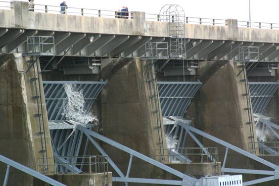
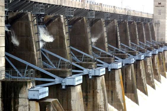
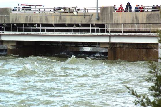
Notice the water passing over the tops of the flood gates underneath Highway 165. Keep in mind, these flood gates are raised 2.5 feet to allow the release of water underneath the gates. The lake level when these pictures were taken was at 932.7. The maximum flood pool is approximately 931 feet above sea level. |
|
Front Side of Table Rock Dam |
|
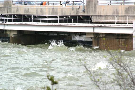
Back Side of Table rock Dam |
|
The US Government owns all the property below the “Government Take Line” or flood plain on Beaver, Table Rock, Bull Shoals and Lake Norfolk. No private or commercial building is allowed on Government Property, or in the flood plain. Consequentially, the flood damage on these four lakes was minimal, mostly just debris or stranded boat docks that you could not get to. Some public campgrounds controlled by the Corp of Engineers are permitted below the Government Take Line and are closed until the lake levels reseed. |
|
Sue Andersen Realty 417-334-8152 sueandersenrealty@gmail.com Please copy and paste address! |