
|
Branson, Mo Flood 2008 Table Rock and Taneycomo Lakes Presented by Sue Andersen Realty |
|
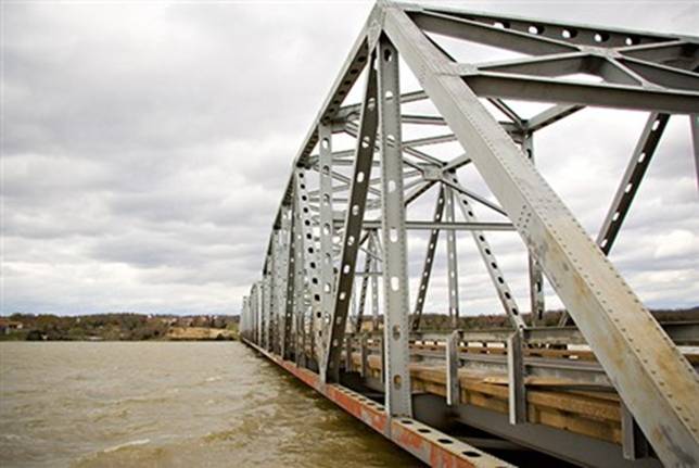
Kimberling City Bridge - April 10, 2008 |
|
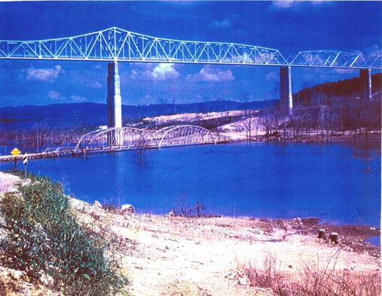
Kimberling City Bridge - Approximately 1957 |
|
The Legends
In 1957, prior to the completion of Table Rock Dam, a very close friend of mine purchased a piece of property adjacent to these photos. The property was purchased from the original homesteader who had lived there most of his life with no electricity or running water for $50.00 per acre (now Kimberling City). My friend and the homesteader were on the banks of the White River discussing the property. He told the homesteader that the experts predicted that it would take 3 years for the lake to fill. The old homesteader just laughed and said, “ It will fill in less than 1 day.”
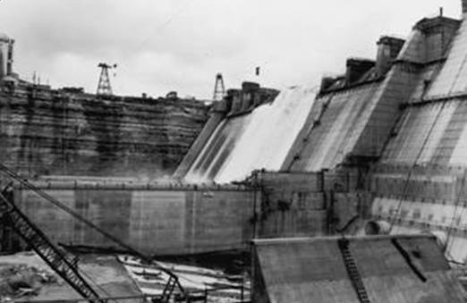
My friend continued the story to tell me that the homesteader who had less than an elementary education was indeed wrong. He went on to tell of a flash flood that came in the Spring 1957, filling the lake in three days! Many of the original Homesteaders had to evacuate their homes. The top of the center of Table Rock dam was not yet complete. The massive amount of water went over the center destroying forms and equipment and delayed the completion of the dam for 1 year. I have no way of knowing what exact elevation the lake was when it overflowed the center. But one thing I can say for sure is that the old homesteader had a healthy respect and knowledge of the wild White River Basin.
One of the legends that remains today concerning the filling of Table Rock Lake is the proposed dismantling of the old highway 13 bridge seen above. As the legend goes, trucks and equipment were still on the old bridge in preparation for its dismantling in 1957 when they were overtaken by the flood waters. To this day, the Old Hwy 13 bridge is 100 to 140 feet under water. |
|
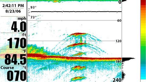
Special thanks to Doug Vahrenberg for his contribution of images from his Humminbird Side Imaging Electronics
Sponsors: Skeeter Boats, Yamaha Outboards, MinnKota Motors & Chargers, Humminbird Electronics, Navionics Charts, Transducer Shield and Saver, LuckyCraft Lures, Daiwa Rods & Reels, Dave's Custom Baits, Secret Lures, Smithville Marine, AGCO & Massey Ferguson Farm Equipment |
|
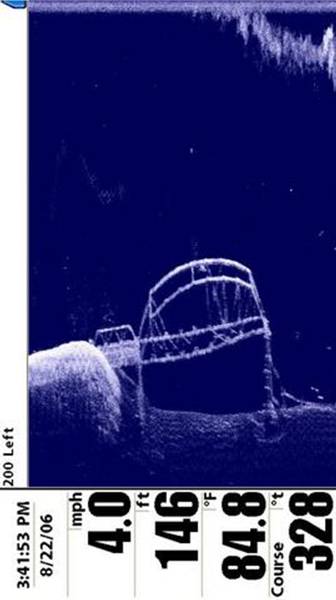
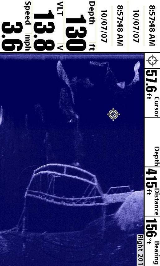
Submerged Old Highway 13 Bridge Table Rock Lake Images captured by “Humminbird Side Imaging Electronics” |
|
Reverse angle North End of Old Highway 13 Bridge |
|
North End of Old Highway 13 Bridge |
|
These images were taken of the Old Highway 13 Bridge adjacent to Kimberling City. It is interesting to note that several of the diagonal braces are gone causing the massive sway.
It is hard to image, that after all these years we are once again able to view the old bridge.
Top of structure: 100 ft depth
Floor of structure: 146 feet
Bottom of old creek bed: 170
feet |
|
Flood of 1957 - Table Rock Dam not complete! |
|
Courtesy Doug Vahrenberg www.dougvahrenberg.com |
|
Sue Andersen Realty 417-334-8152 sueandersenrealty@gmail.com Please copy and paste address! |