
|
Quote of the day! Our value is not determined by who we are, what we do, or what we look like, but by the Price that was paid for us. Romans 5: 8 |
|
Sue Andersen |
|
Branson, Mo Flood 2011 Table Rock and Taneycomo Flooding Presented by Sue Andersen Realty |

|
Observations by a 33 year Local! As Accurate as my Memory Allows - Which is getting worse?? April 2011 |
|
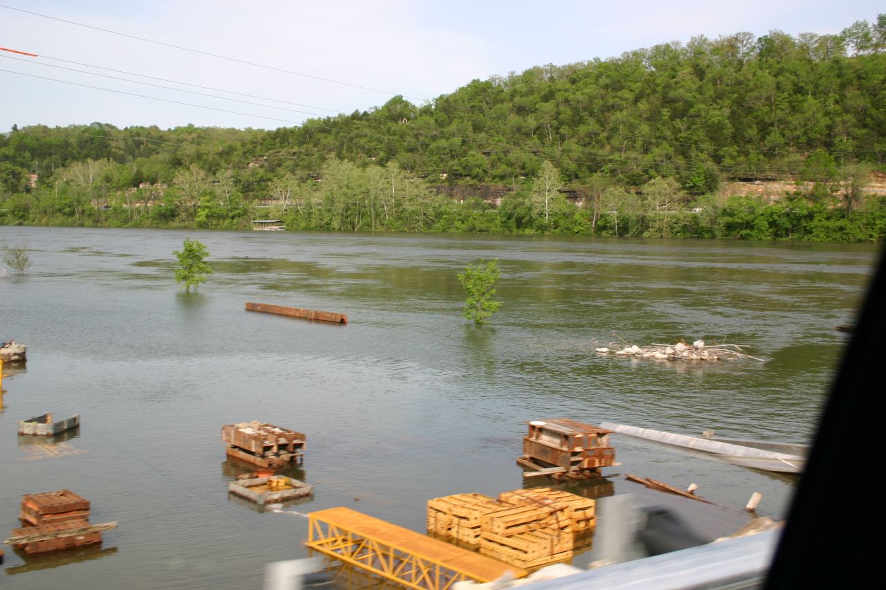
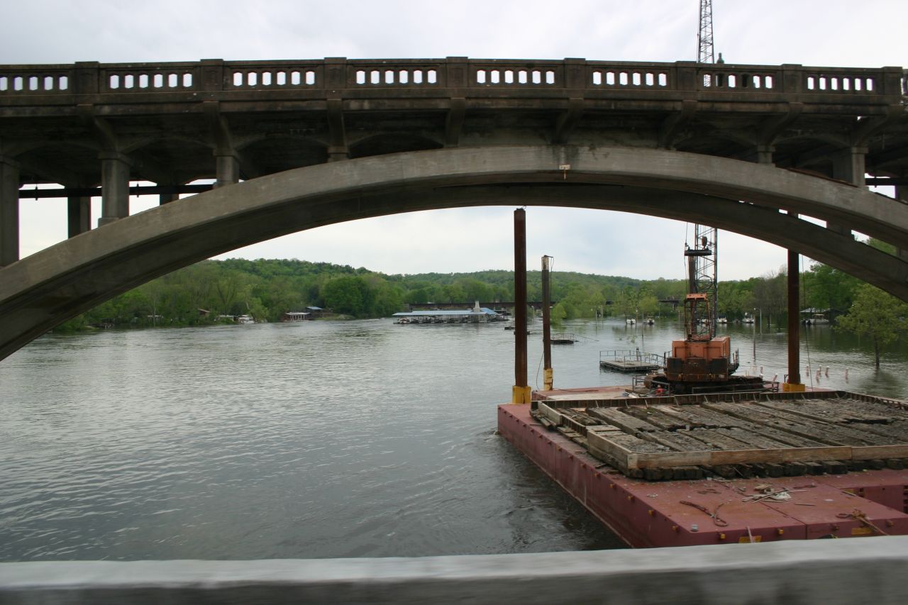
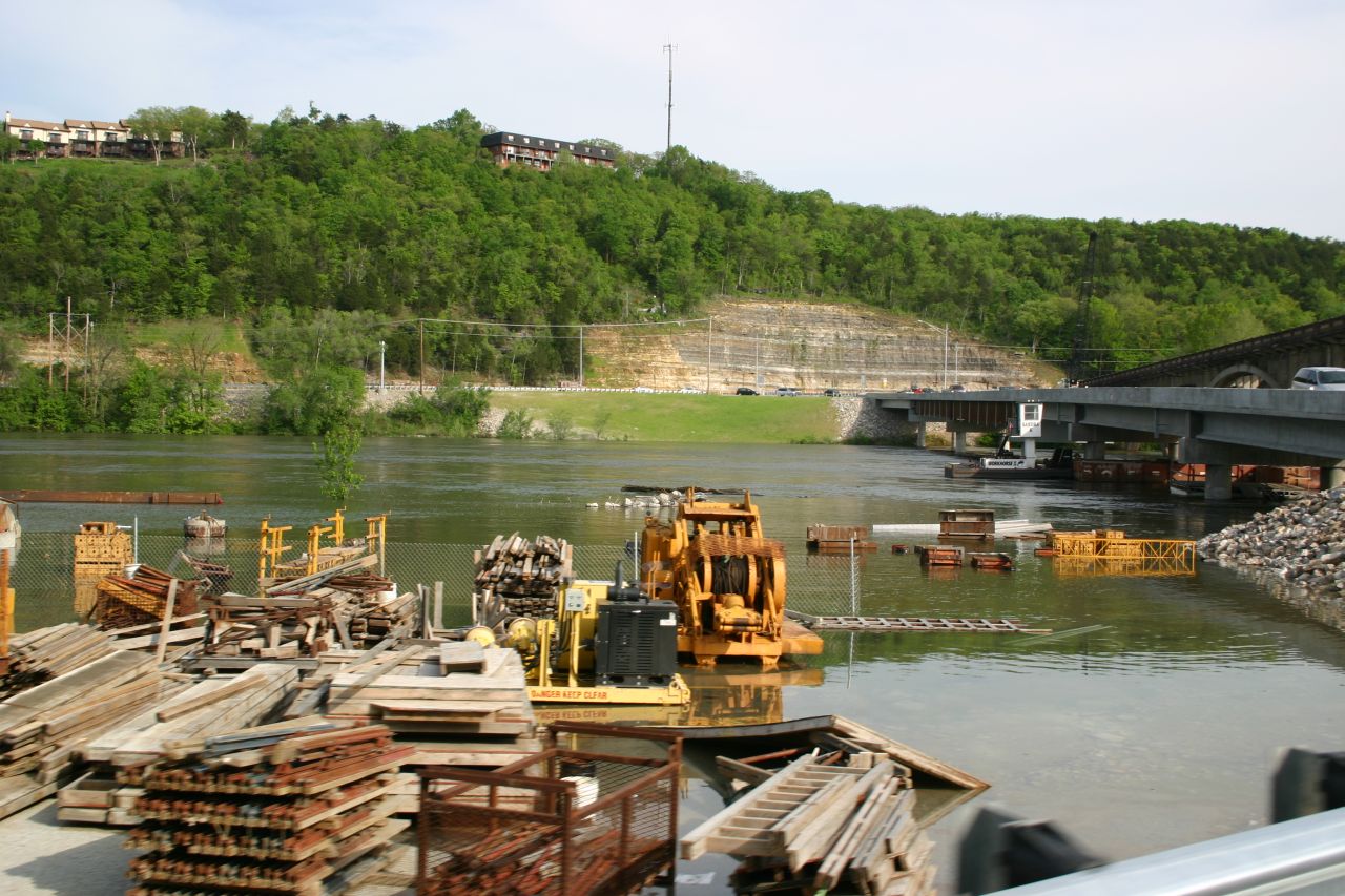
Taneycomo Arch Bridge under Renovation - Flood April 2011 Worst flood since contruction of Table Rock Dam! The Taneycomo Arched bridge was built in 1934. Notice the newly completed bridge below the arched bridge. |
|
The “Wild White River Basin” The original homesteaders had a great respect for the “Wild White River Basin” and often told of 50 foot walls of water coming down the valleys. To understand what the homesteaders were talking about, you have to consider the watershed of the White River (now Table Rock and Taneycomo). The Table Rock watershed begins north of Springfield, Mo at approximately I-44 Interstate and extends south to Fayetteville, Ark. This total watershed area is about the size of 1/4 to 1/3 of the state of Missouri. This runoff is funneled / channeled into the White River which eventually winds between the hills and mountains of the Ozarks. The Ozark hills and mountains narrow the channel or keep the channel from widening. All the water from Springfield, Mo to Fayetteville, Ark must pass between these hills and mountains.
Our acquaintances include some of the families and friends of the original homesteaders. They would tell of the massive walls of water coming down the White River with no warning or rain clouds even in site. The watershed of Fayetteville to Springfield may get a massive rain sending the runoff downstream to those unaware.
This “White River Basin” was somewhat tamed with the completion of 4 major Dams (Includes Table Rock - 1958). In the approximate 50 years since the completion of the Dam projects, there have been only two floods caused by major releases of water from Table Rock Dam (2008 and 2011).
For more information on Table Rock Dam construction and flooding, please visit http://sueandersenrealty.com/flood2008/index_files/page0006.htm, written after the 2008 flood. |


|
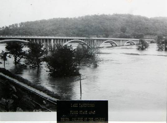
Taneycomo Arch Bridge - Flood 1945 - Before Table Rock Dam This picture was taken during the flood of 1945. Notice the far arch - it would be difficult for a boat to pass under the bridge. This was not a one time only happening (flood). The old time homesteaders knew and respected the power of the “Wild White River Basin” |
|
Branson Landing April 2011 Flood - Minus the Bass Pro Boat Dock and store that went for a cruise downstream. |
|
Taneycomo Arch Bridge under renovation.
Picture taken from the newly completed adjacent bridge during the high water flood of April 2011. |
|
Taneycomo Newly Completed Bridge next to the Arched Bridge
|

|
For more information on Lake Taneycomo, Table Rock Lake Historic Kimberling Bridge Flooding History visit: |