
|
Sue Andersen |
|
Branson, Mo Flood 2011 Historic Hollister 1945 Comparison Pictures Presented by Sue Andersen Realty |
|
Branson, MO |

|
Observations by a 33 year Local! As Accurate as my Memory Allows - Which is getting worse?? April 2011 |
|
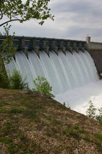
Reference levels Table Rock top of flood pool - 931.00 Beaver top of flood pool - 1130.00 Bull Shoals top of flood pool - 695.00 Norfolk top of flood pool - 580.00 |
|
Branson is Alive and Well! April 2011 The White River Basin
The “Wild White River Basin” has been somewhat tamed by a series of four dams on the White River. I have included several pictures for comparison of the 2011 flood and the 1945 flood (one of many floods before Table Rock Dam was built). |
|
Historic photos on left are courtesy of Stan Moore |
|
Downtown Hollister - Flood of 1945 The picture on the left was taken in 1945 from the railroad tracks in downtown Hollister. The family that owned the Dry Goods store at that time (right set of buildings) are friends of ours. We believe he is the young man pictured in the canoe. This building is currently an antique store. The Old English Inn is the large building on the extreme left in the picture. |
|
Taneycomo Flood 1945 My best guess is that the water level in downtown in this picture is 15 feet higher that the 2011 flood. |


|
For more information on Lake Taneycomo, Table Rock Lake Historic Kimberling Bridge Flooding History visit: |
.jpg)
|
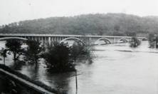
Branson is Alive and Well! April 2011 The White River Basin
The picture on the right was taken from above the railroad tracks. To get an idea of the water level during the flood of 1945, before Table Rock Dam, count the vertical arch supports from the dominant center support to where they intercept the water level. Relate that level to one of the 2011 photos. |
|
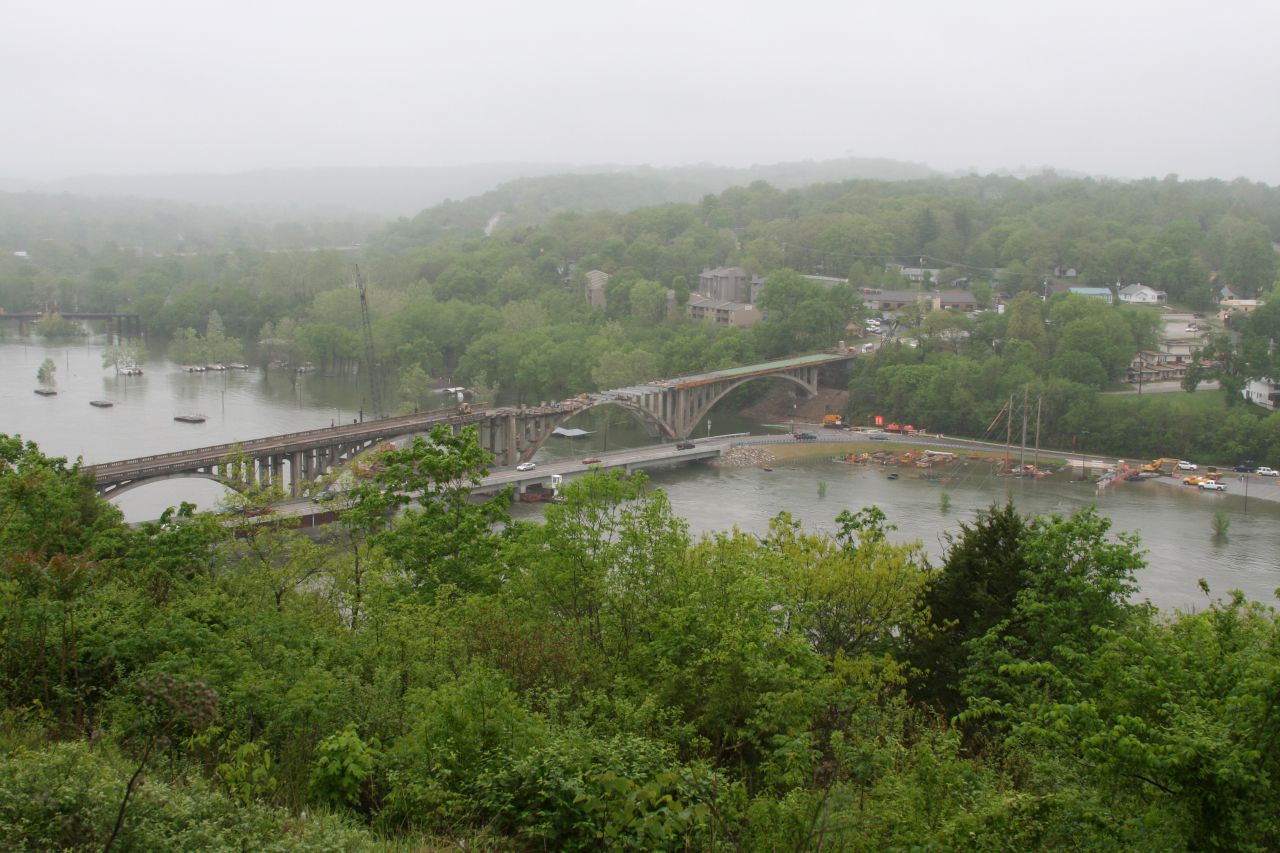
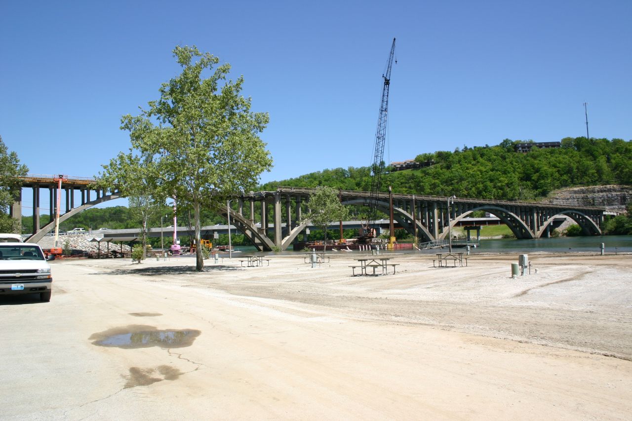
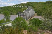
Taneycomo Arched Bridge - High Water Stage 2011 I have drawn a red line on the above photo at the approximate water level in the 1945 flood. You can get an idea of how large this bridge is by searching for the worker on top of the Arched Bridge by the pink lift (crane). |
|
Taneycomo Arched Bridge - Flood 2011 at Highest Water Level This picture was taken from Mount Branson of the Arched Bridge during the 2011 Flood with water level in Taneycomo Lake at it’s record high level since the completion of Table Rock Dam. |
|
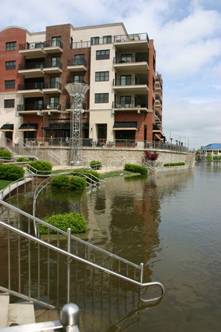
Hollister 2011 This picture was taken April 2011 from approximately the same location as the Historic 1945 Hollister picture on the left. |
View the 2011 Branson Flood Picture Gallery
View all Branson 2011 Flood Pictures Full Size
Downloads Allowed
View the 2011 Branson Flood Picture Gallery
View all Branson 2011 Flood Pictures Full Size
Downloads Allowed
|
Full screen size images are available on some pictures by clicking on the image! Please use your “Back” button to return! |
|
Branson Flood 2011 |